Domains
Domains provide an easy way to constrain the valid values that can be populated for an event layer. If your database is not set up as an ESRI enterprise geodatabase, domains will be populated through the LRS Metadata in App Manager's Administration settings. The steps below will guide you through the process of adding and editing domains through the LRS Metadata seed file.
To edit domains in the LRS Metadata, you will first need to download the relevant seed file that references domains. This can be done using the Export Seed Data functionality. LRS Metadata has a stand-alone seed file that can be exported to the user’s desktop and edited directly.
Heads Up! The seed file is formatted as JSON, so users should be familiar with JSON formatting prior to editing the seed file.
Tip: Ensure that any pop-up blockers are disabled on this page or the user will not be able to download the file.
- Select the LRS Metadata seed file and click Download Selected.
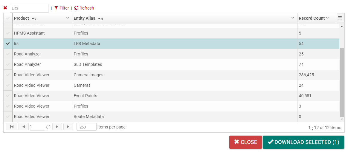
- The file will download to the default downloads folder; you can open it using any text editor.
The easiest way to add a domain is to copy and paste the formatting for an existing domain, then update the new domain with its code and name values.
- The section for domains should be near the top of the file; if not, you will need to search for the relevant section. The domains will be represented as an array with the “domains” heading, as highlighted in the below picture.
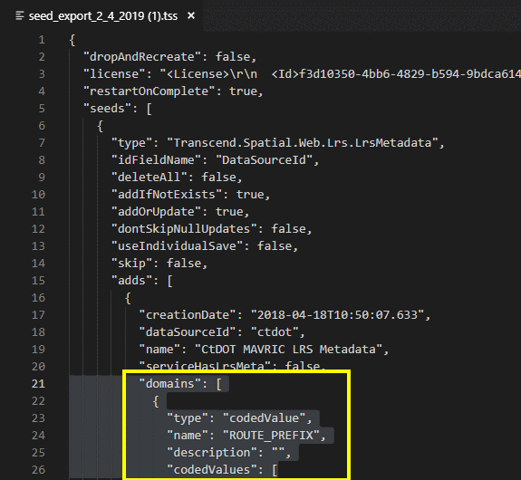
- Your text editor should highlight where the code for that domain begins and ends.
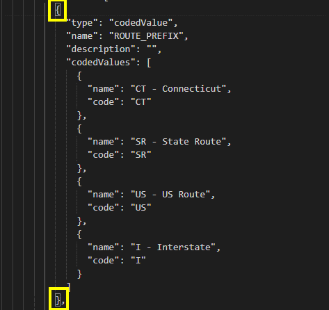
- Copy and paste the entire selection, then enter a name for the new domain and clear out the ‘name’ and ‘code’ values, to avoid accidental duplication.
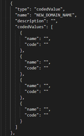
- Enter the respective code and name values for the new domain. The code value represents the value that will actually be stored in the database, while the name is the textual representation of that code. Typically, the name is used to provide you an explanation for an abstract code value.
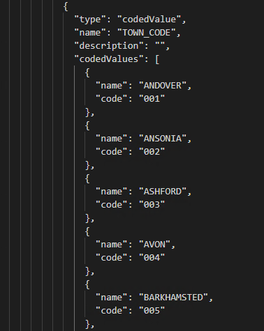
Tip: Save the file regularly.
Repeat the steps above to create all the new domains you need.
Once the domain has been created, you will need to associate the domain with the appropriate layer(s) and field(s). There are several sub-headings referencing data used by Rizing Geospatial's applications. These are:
- "networkLayers"
- "eventLayers"
- "nonLRSLayers"
- Use these sub-headings to navigate to the appropriate layers. Domain information will be referenced in the ‘fields’ array associated with the layer.
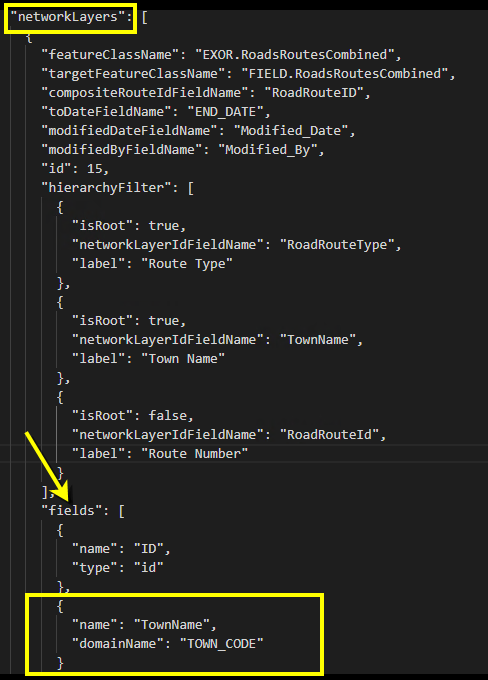
- Associate all new domains with the correct layer(s) and field(s).
- Save the file and begin the import process.
Once the seed files have been updated, they will need to be imported into TDS so that the new domains can take effect. You can find those steps in the Import Seed Data topic.
